James Diggle and John Underhill
I: INTRODUCTION
James Diggle
It is now more than twenty years since Robert Bittlestone put to us his hypothesis about the location of Homer’s Ithaca, the homeland of Odysseus. Robert realised that Ithaca cannot be the modern island of Ithaki, as most people have supposed. He argued the case in the book entitled Odysseus Unbound, which he wrote with our help.
The theory set out in the book was well received: “There seems to be no doubt at all that Paliki was once a separate island from the rest of Kefalonia” (Mary Beard); “Bittlestone’s theory is fundamentally simple… and it is almost certainly correct” (Peter Green); “This book is a gem… Reading the Odyssey is unlikely ever to be the same again” (Gregory Nagy).
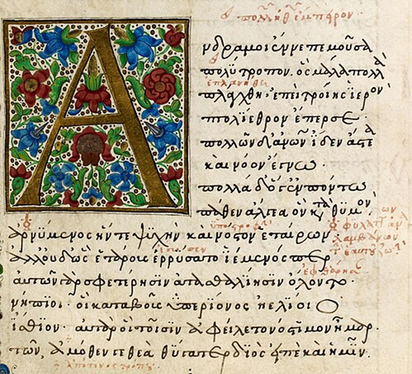
Let us begin with Odysseus’ own description of Ithaca:
ναιετάω δ᾽ Ἰθάκην εὐδείελον· ἐν δ᾽ ὄρος αὐτῆι
Νήριτον εἰνοσίφυλλον, ἀριπρεπές· ἀμφὶ δὲ νῆσοι
πολλαὶ ναιετάουσι μάλα σχεδὸν ἀλλήληισιν,
Δουλίχιόν τε Σάμη τε καὶ ὑλήεσσα Ζάκυνθος·
αὐτὴ δὲ χθαμάλη πανυπερτάτη εἰν ἁλὶ κεῖται
πρὸς ζόφον, αἳ δέ τ᾽ ἄνευθε πρὸς ἠῶ τ᾽ ἠέλιόν τε.
Od. 9.21–6[1]
Odysseus is describing Ithaca to Alcinous, the ruler of Scherie, the island of the Phaeacians, which is usually assumed to be the modern Corfu. I shall give this, and the other passages which I shall quote, in the translation which I gave in the book:
Bright Ithaca is my home: it has a mountain,
Leaf-quivering Neriton, far visible.
Around are many islands, close to each other,
Doulichion and Same and wooded Zacynthos.
Ithaca itself lies low, furthest to sea
Towards dusk; the rest, apart, face dawn and sun.
This description gives us three important pieces of information, three clues to the location of Ithaca. First, it associates Ithaca with three islands, Doulichion and Same and Zacynthos. Second, it tells us that Ithaca lies to the west of these islands. Third, it tells us that Ithaca is low-lying, in other words that it is not mountainous.
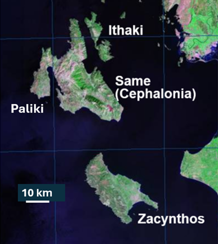
Can we identify any of these islands? Zacynthos is easy. Everyone accepts that Homer’s Zacynthos is the same as the island that has that name today, the island that lies south of Cephalonia. What about Same or, as Homer sometimes calls it, Samos? Scholars in antiquity identified Same/Samos with the island of Cephalonia, on which there is today, and has been since early times, a town called Sami. This leaves us with two islands still to locate, Doulichion and Ithaca. But we appear to have only one island left. If Ithaki is Ithaca, then where is Doulichion?
What of the other two clues? Is Ithaki furthest west of these islands? No, it is furthest east. Is it low-lying? No, it is mountainous, with cliffs plunging sheer into the sea.
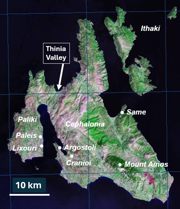
Robert Bittlestone came up with a brilliant solution to this dilemma. He suggested that Ithaca is the western peninsula of Cephalonia, which is today called Paliki after its ancient capital city Paleis. In doing so, he was reawakening (as he later discovered) a theory first proposed by a local historian Gerasimos Volterras in 1903.[2]
Paliki is the westernmost part of this group of islands. And it is low-lying, in relation to both Ithaki and even more to its immediate neighbour Cephalonia. On Cephalonia, Mount Ainos rises to a height of 1,640 metres. The highest ground on Paliki rises to no more than 517 metres. So, if we identify Ithaca with Paliki, this frees the island of Ithaki to be identified with Doulichion. It may seem arbitrary or cavalier to switch the names. But there is plenty of evidence that Ithaki was once called Doulichion.[3]
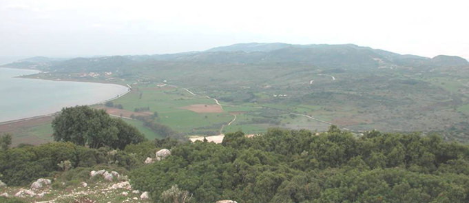
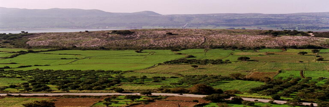
Appealing as this solution was, there appeared to be one obstacle standing in its way. Paliki is not an island: it is a peninsula that is connected to the main body of Cephalonia by a narrow land bridge, 6km long and 2km wide, centred on the Thinia Valley.
Robert devised a way of removing this obstacle. He read an account of the landscape of Cephalonia by the Greek geographer Strabo, who, around the beginning of the 1st century AD, wrote a very long work covering the geography of the whole of the then known world. When he came to write about Cephalonia, he said (in the Loeb translation by H.L. Jones):
“Where the island is narrowest it forms a low isthmus, so that it is often submerged from sea to sea. Near the narrows, on the gulf, are Paleis and Cranioi.”
From this passage we can deduce that Strabo is referring to the Thinia valley at the head of the modern Gulf of Argostoli that separates Paleis and Cranioi. He says that in his day (or in that of the writers from the mid-2nd Century BC who were his sources) it was often submerged by water flowing between the coast to the north and the coast to the south. But here we meet a problem. Today the Thinia valley at its highest point rises to around 200 metres above sea level. Water does not flow through that valley from sea to sea today.
But (Robert argued) suppose that in the Late Bronze Age, at the time of the Trojan war (that is, around 1200 BC), what in Strabo’s time was a low isthmus sometimes inundated by an overland watercourse was a navigable marine channel that separated Paliki from Cephalonia. Paliki would then have been not a peninsula but an island. Suppose (he continued) that between the Late Bronze Age and the present day that marine channel was infilled with rock that had fallen from the high ground on each side of it, precipitated by earthquakes, to which Cephalonia is especially prone.
This was a bold and brilliant hypothesis, and we have spent twenty years acquiring geoscientific data to test whether it might be true.

II: GEOSCIENCE
John Underhill
Robert realised that his hypothesis was dependent on a thorough geological understanding, and so he looked for someone who might know the terrain. Since I had previously undertaken PhD research entitled “Late Neogene and Quaternary Tectonics and Sedimentation in Western Greece”, in which Cephalonia figured heavily, the island’s geology was not only familiar to me but had also led to publications in international journals. Having come across these as he scoured the internet, Robert approached me to lead the geological investigations, and I agreed to meet him and James in Cambridge in the spring of 2003.
As I listened to their account of Homer and Strabo, I realised that it would be possible to test Robert’s theory through geoscientific enquiry by investigating the surface geology and the subterranean geology hidden below. I returned to the island and undertook fieldwork in the Thinia Valley, an exercise that led to the production of a new geological map that superseded all previous ones.
This map showed that the geological bedrock that outcrops on both flanks of the valley consisted of Cretaceous and Paleogene limestones (c. 75–34 million years old), that dipped towards the east on the western side and to the west on the eastern side. The middle of the valley contained a narrow ridge of the same Cretaceous and Paleogene limestones that dipped to the east, encased within younger, Neogene (c. 23–2.5 million years old) marl- and sandstone-dominated clastic sediments. Field relationships showed that the intermediate ridge represented a thrust-bound sliver, the trace of which was lost beneath a low lying plain in the Katochori area.
The lithological contrast between the hard limestone and soft clastic sediments has controlled the geomorphology within the valley. The outcrop of the more easily eroded rocks has dictated where river channels run to the north and southern coast.
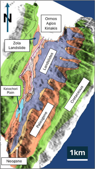
The mapping also demonstrated that some of the geological formations, their boundaries and tectonic structures, could not be traced at the surface throughout the whole valley as they are obscured by rockfalls and landslides. This was especially so where the valley sides are steep, such as near the village of Zola in the northwest part of the valley.
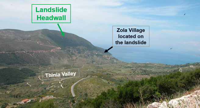
the village of Zola is situated.
The mapping allowed the stratigraphy and structure seen in surface exposures to be projected into the subsurface and the construction of geological cross sections, showing that a marine channel, if one existed, would be buried on the eastern side of the valley. From the fieldwork, it was clear that the only way to see whether a marine channel existed was to deploy geophysical and geological methods to reveal the subterranean geology.

image of Thinia. Yellow lines indicate the margins of the channel,
and the red spot marks the position of the first borehole we drilled.
A drilling location in southern Thinia was selected that had a surface elevation of 107.5 metres above mean sea level. It was drilled vertically for 5 days. The borehole had a length of 121.25 metres, so that its final depth was 13.75 metres below sea level today. The analysis of the rock cuttings obtained during drilling operations showed that the borehole did not encounter limestone bedrock.
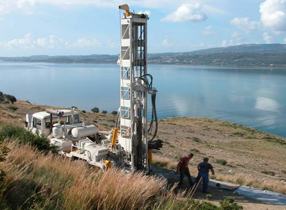
The borehole gave encouragement to the channel theory, because subsequent analysis of its rock cuttings showed that they contained marine fossils. However, as a borehole is limited to a single spot location, the theory needed to be tested in the subsurface throughout Thinia. Precise age dates were also required to reconstruct ancient landscapes (palaeogeography) and look for evidence of marine deposition during the times that Strabo and Homer were depicting. Consequently, we acquired geophysical data in the valley and in neighbouring offshore waters in order to determine the location and number of boreholes we would need to drill and acquire cores from.
From the results, it was clear that a full test of the theory would be a major and expensive undertaking involving serious geotechnical hardware. Given the level of ambition, scale, diversity of methods needed, and the interdisciplinary nature of the research required, Robert and I decided to approach geotechnical companies with the relevant equipment and expertise.
A world-leading geodata specialist, FUGRO, expressed interest and we were invited to discuss the project in their Dutch head office. They subsequently approved the financial support and technical resources needed to conduct the geophysical and geological data acquisition and analysis.
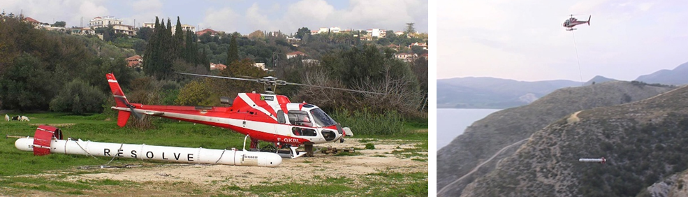
FUGRO’s support of our research led to a full suite of methods being deployed. These included Light Detection and Ranging (LiDAR) remote sensing equipment to map the terrain at an ultra-high resolution, and the acquisition of seismic refraction, seismic reflection, airborne electromagnetics, gravity, and resistivity profiles. Integration of the resulting data allowed mapping of the subterranean geology and production of geological models that are conceptually similar to 3D MRI body scans used in the medical profession. This enabled us to obtain an unprecedented and detailed understanding of Thinia’s stratigraphy and structure.
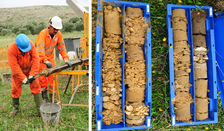
We drilled thirteen boreholes in various locations in the Thinia valley. The rock cores obtained were placed in specially designed tubes, which were shipped to the UK and are now housed in a dedicated core facility in Aberdeen. The sediments they contain were subject to biostratigraphic analysis for microfossils and compared to samples obtained from surface locations.
Integration of all the geoscientific data has allowed us to determine the environments of deposition, age dates, and stratigraphic correlations between the sample sites, all of which provide the crucial test of the marine channel hypothesis.
From these results, we can now demonstrate that the Thinia valley last hosted marine waters at some period between 400,000 and 290,000 years ago. In other words, the hypothesis that a marine channel extending the length of the valley existed during Roman or Late Bronze age times is disproven.
But before we take leave of geoscience, let us take a closer look at that passage of Strabo (“Where the island is narrowest it forms a low isthmus, so that it is often submerged from sea to sea”), which Robert regarded as offering support to his hypothesis. The verb ὑπερκλύζεσθαι (hyperklyzesthai), which is translated (in the Loeb) as “is submerged”, literally means “is washed over”. The prefix ὑπερ- indicates “over/above” (the ground). In other words, Strabo is describing a watercourse passing overland, not a marine channel. It is unfortunate that Robert coined (and we have continued to use) the term “Strabo’s channel” to describe the hypothetical channel. In effect, the channel is Robert’s, not Strabo’s. Henceforth, it will be better to refer to Strabo’s watercourse.
Our geoscientific work throws new light on what Strabo was describing. The mapping showed that river valleys are located within the outcrops of softer and more easily eroded (Neogene) sediments that can be traced continuously to either end of Thinia. The river valleys join at a watershed, to the south of which lies a canoe-shaped shallow basin centred on Katochori Plain.
In 2022 and 2024, we excavated and sampled the walls of six trenches in the Katochori area to determine the nature and age of the non-marine sediments that form the shallow (2–3m depth) part of the section. We used Optical Spectral Luminescence (OSL) techniques on the samples to determine the ages. The results demonstrate that the Katochori Plain hosted a shallow basin, the infill of which consists of a meadow that occasionally flooded to form a freshwater lake.
The OSL ages show that it was created around 75,000 years ago, was present throughout the Bronze Age and Roman times, and continued to be a feature throughout the last two millennia and still floods during extreme weather events. When the lake was full, waters drained out of it and flowed into the sea at both ends of the valley, in courses which are still identifiable.
In other words, the geoscience is entirely consistent with there having been a continuous water course running overland from time to time, with the result that Paliki was occasionally separated from the rest of Cephalonia. The existence of the lake and the waters that drained from it were illustrated in Odysseus Unbound, 368–74, but we did not realise their full significance until now. We can now infer that this is the feature which Strabo describes.
III: CONSEQUENCES
James Diggle
Robert Bittlestone thought that we might be able to demonstrate that Paliki was the island of Ithaca by demonstrating that Paliki, now a peninsula of Cephalonia, was once an island, separated from Cephalonia by a navigable marine channel. From the geoscientific studies described by John in the previous section, we now know that there was no marine channel at the time of Strabo or during the Late Bronze Age.
So where does this leave us? There were two parts to Robert’s original hypothesis. First, that Paliki was Homer’s Ithaca. Second, that Paliki was once an island. Robert assumed that you cannot have one part of his hypothesis without the other: Paliki cannot be Ithaca unless Ithaca is an island, and for Ithaca to be an island you need a marine channel.
So, if no marine channel existed, does the idea that Ithaca was Paliki come crashing to the ground? This was the question that I had to put to myself as soon as it became clear that there was no channel. I began by questioning one of Robert’s original assumptions: that Ithaca was an island. It was a natural assumption to make. Virtually everyone, from antiquity to the present day, has assumed that Ithaca was an island.
But does Homer say that Ithaca was an island? It did not take me twenty years to discover the answer. Homer has many opportunities to call Ithaca an island, but he never does so. Instead, he (or his characters) refers to it constantly as ‘land’ (γαῖα, gaia, e.g. 1.21), “native land” (πατρίς, patris, e.g. 1.75, πατρὶς αἶα/γαῖα, e.g. 1.75, 1.290), “country” (δῆμος, dēmos, for which see below).
This fact is highly significant. I am reminded of a celebrated riposte by Sherlock Holmes. Inspector Gregory says to Holmes: “Is there any other point to which you would wish to draw my attention?”—Holmes: “To the curious incident of the dog in the night-time.”—Gregory: “The dog did nothing in the night-time.”—Holmes: “That was the curious incident.”[4]
To rephrase: “Is there any other point to which you would wish to draw my attention?” —”To the curious fact that Homeric Ithaca is said to be an island.”—”But Homer does not say that Ithaca is an island.” — “That is the curious fact.”
Now, there are several places where it may appear that Homer does call Ithaca an island. But on closer examination it turns out that he does not. Let us first have another look at the passage which I quoted earlier: “Bright Ithaca is my home… Around are many islands, close to each other, / Doulichion and Same and wooded Zacynthos.” Homer says “many islands”. If Ithaca is an island, why does he not say “many other islands”? The passage ends with the lines “Ithaca itself lies low, furthest to sea / Towards dusk; the rest, apart, face dawn and sun.” “Ah,” you may say, “the rest” implies “the rest of the islands”. But my translation is wrong. It is wrong because I was led astray by the assumption that Ithaca is an island. What Homer says is not “the rest”. He says “but they” (αἳ δέ, that is, “but they, the islands just mentioned”). This passage, then, offers no evidence that Ithaca is an island.

There are three further passages where Ithaca is compared with the neighbouring islands. First, we have Telemachus, Odysseus’ son, describing Ithaca:
ἐν δ᾽ Ἰθάκηι οὔτ᾽ ἂρ δρόμοι εὐρέες οὔτε τι λειμών·
οὐ γάρ τις νήσων ἱππήλατος οὐδ᾽ εὐλείμων,
αἵ θ᾽ ἁλὶ κεκλίαται· Ἰθάκη δέ τε καὶ περὶ πασέων,
αἰγίβοτος, καὶ μᾶλλον ἐπήρατος ἱπποβότοιο.
4.605–8
Ithaca has no meadows or broad horse-runs;
Neither has any of the sea-perched isles.
But there’s not one so fair as Ithaca,
Goat-land, more lovely than horse-grazing land.[5]
Once again, Homer says “any of the isles”, not “any of the other isles”. And once again, in translating the last line, I have gone astray. The translation “But there’s not one so fair as Ithaca” might be taken to imply that Ithaca is one of the isles. The correct translation is “But Ithaca surpasses them all”, that is “surpasses all those islands”. So, once again, the passage offers no evidence that Ithaca is an island.
Second, we have Telemachus listing the suitors of Penelope:
ὅσσοι γὰρ νήσοισιν ἐπικράτεουσιν ἄριστοι,
Δουλιχίωι τε Σάμηι τε καὶ ὑλήεντι Ζακύνθωι,
ἠδ᾽ ὅσσοι κραναὴν Ἰθάκην κάτα κοιρανέουσιν.
1.245–7
All of the noble lords who rule the islands,
Doulichion and Same and wooded Zacynthos,
And all who rule in rocky Ithaca.[6]
Here, once again, we have the familiar trio of islands (Doulichion, Same, Zacynthos), and they are called islands, but Ithaca, once again mentioned separately and last, is not called an island.
Third, again referring to the suitors:
οὔθ᾽ ὅσσοι κραναὴν Ἰθάκην κάτα κοιρανέουσιν
οὔθ᾽ ὅσσοι νήσοισι πρὸς Ἤλιδος ἱπποβότοιο.
21.346–7
Not those who rule in rocky Ithaca
Or on the islands off horse-grazing Elis.
Ithaca is again contrasted with “the islands”, not “the other islands”.
There are two passages where Ithaca is contrasted with “the mainland”. In the first, Eumaeus, Odysseus’ loyal pig farmer, describes Odysseus’ vast livestock:
ἦ γάρ οἱ ζωή γ’ ἦν ἄσπετος· οὔ τινι τόσση
ἀνδρῶν ἡρώων, οὔτ᾽ ἠπείροιο μελαίνης
οὔτ᾽ αὐτῆς Ἰθάκης.
14.96–8
His stock was truly vast. No other hero
Had so much, either on the dark mainland
Or Ithaca itself.
The second passage comes from the Iliad:
αὐτὰρ Ὀδυσσεὺς ἦγε Κεφαλλῆνας μεγαθύμους,
οἵ ῥ᾽ ᾽Ιθάκην εἶχον καὶ Νήριτον εἰνοσίφυλλον
καὶ Κροκύλει᾽ ἐνέμοντο καὶ Αἰγίλιπα τρηχεῖαν,
οἵ τε Ζάκυνθον ἔχον ἠδ᾽ οἳ Σἀμον ἀμφενέμοντο,
οἵ τ᾽ ἤπειρον ἔχον ἠδ᾽ ἀντιπέραι᾽ ἐνέμοντο.
Il. 2.631–5
Odysseus led the gallant Cephallenians,
From Ithaca and leaf-quivering Neriton,
From Crocyleia and rugged Aigilips,
Men hailing from Zacynthos and from Samos,
From the mainland and the region opposite.
In the former passage, Odysseus is described as possessing livestock on the “mainland” as well as on Ithaca itself. The “mainland” is certainly Samos/Same, not the mainland of Greece (see Odysseus Unbound, Chapter 8). In a moment I shall introduce the herdsman Philoitios, who looked after the livestock on Samos/Same.
The second passage, which records that Odysseus led to Troy a group of people collectively called ‘Cephallenians’, is complex and problematic. As it stands, it is hard to fathom. In Odysseus Unbound, 513–14, I argued that lines 632–4 and line 635 are alternative ways of describing Cephallenians; that they were never designed to stand alongside each other; and that the omission of line 635 by a papyrus shows that in antiquity some readers considered this line to be incompatible with lines 632–4. I concluded that “the mainland” is, again, Same/Samos and that “the region opposite” is Ithaca.
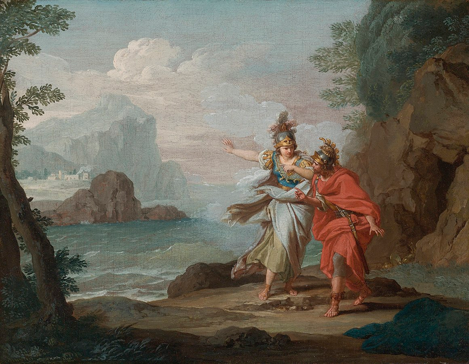
And now a passage which I regard as particularly telling. Odysseus finally reaches Ithaca, on a ship rowed by his Phaeacian hosts:
τῆμος δὴ νήσωι προσεπίλνατο ποντοπόρος νηῦς.
Φόρκυνος δέ τίς ἐστι λιμήν, ἁλίοιο γέροντος,
ἐν δήμωι Ἰθάκης.
13.95–7
Then the seafaring ship approached the island.
On Ithaca there is a bay of Phorcys,
The old man of the sea.
“Ah,” you will say, “so Homer does describe Ithaca as an island after all.” Not so fast. The phrase which I have translated, for the sake of my metrical scheme, as “on Ithaca” is ἐν δήμωι Ἰθάκης, which means (roughly) “in the country of Ithaca”. In Homer, δῆμος designates either an inhabited region or the inhabitants of a region. This phrase “the δῆμος of Ithaca” is used eight further times in the Odyssey and once in the Iliad.[7] Why is it always the δῆμος, never the νῆσος, of Ithaca? The two words are identical in metre. In every place where the word is used to describe Ithaca, Homer could have said νῆσος. But he always says δῆμος.
If we look more closely at our passage, we can see what is happening. “The ship approached the island.” But it does not come to shore “on the island”. It comes to shore ἐν δήμωι ᾽Ιθάκης, “in the country of Ithaca.” Ithaca, so far from being “the island”, is distinguished from the island. It is only a part of the island.

Not only does Homer distinguish Ithaca from the nearby islands by referring to it as a δῆμος, rather than a νῆσος. He also distinguishes it by denying to Ithaca an epithet which he elsewhere applies to islands and by instead giving it an epithet which he never applies to islands, although these epithets appear to be, at first sight, synonymous and interchangeable. The epithet which he applies to islands is ἀμφίρυτος (amphirhytos), “with water flowing all around, sea-girt” (1.50, 198, 11.325, 12.283). The epithet which he applies to Ithaca is ἀμφίαλος (amphialos), “surrounded by sea, sea-girt” (1.386, 395, 401, 2.293, 21.252). I have given, in both cases, the definition and translation of the Cambridge Greek Lexicon. In metre, these epithets are interchangeable. In sense, they are apparently synonymous.
And yet, if they are synonymous, why is no island described as ἀμφίαλος, and why is Ithaca never described as ἀμφίρυτος? In other Greek poets ἀμφίρυτος reappears a dozen or more times as an epithet for islands. ἀμφίαλος reappears only thrice, twice as the epithet of an island (Lemnos, in Sophocles, Philoctetes 1464, Dia in Apollonius Rhodius, Argonautica 4.425),[8] and once (significantly) with reference to the isthmus of Corinth (Pindar, Olympian 13.40), “flanked by two seas” (Cambridge Greek Lexicon). It is, at the very least, a reasonable inference that the epithet applied by Homer exclusively to Ithaca, ἀμφίαλος, was chosen because it describes a feature different from that described by the epithet applied exclusively to islands, ἀμφίρυτος. In other words, that it describes an Ithaca which does not have sea “flowing all around”, like an island, but has sea which is merely “around” (ἀμφι-) an unspecified part of it. In Pindar, as we have seen, “around” means “on two sides of”. Paliki is surrounded by sea on three sides.
But, even if Homer never says that Ithaca was an island, and uses terms which are compatible with its not being an island, is there any passage in the Odyssey which requires it to be an island? Robert thought that there were two such passages.
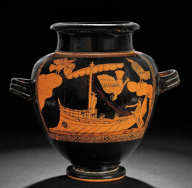
First, we hear of a ferry service by which cattle are brought over to Ithaca. The cowherd Philoitios arrives in Ithaca,
βοῦν στεῖραν μνηστῆρσιν ἄγων καὶ πίονας αἶγας.
πορθμῆες δ᾽ ἄρα τούς γε διήγαγον, οἵ τε καὶ ἄλλους
ἀνθρώπους πέμπουσιν, ὅ τίς σφεας εἰσαφίκηται.
20.186–8
Leading a heifer and fat goats for the suitors.
They had been brought across by ferrymen,
Who also ferry people, any who come.
So, there was a stretch of water which had to be crossed by a ferry. Robert argued that this stretch of water was the channel separating Ithaca from Samos/Same. But we do not need a navigable channel. The ferry service will have been across the Gulf of Argostoli, that is, the strait separating Paliki from Cephalonia. A ferry crosses that strait today, from Argostoli on Cephalonia to Lixouri on Paliki.
There is a piece of linguistic evidence which supports this. The word used for “ferrymen” is πορθμῆες (porthmēes), which means “persons who provide transport across a πορθμός”. And a πορθμός (porthmos), to quote the Cambridge Greek Lexicon, is “a strip of water traversable by ferry, strait, channel.” This word πορθμός is used just twice in the poem, both times to describe the strait between Samos/Same (Cephalonia) and Ithaca (Paliki), ἐν πορθμῶι Ἰθάκης τε Σάμοιό τε παιπαλοέσσης, “in the strait / That lies between Ithaca and rugged Samos” (4.671, 15.29). The reference in this repeated line is to the strait in which the suitors lay their ambush for Telemachus – they lay it in the southern part of the strait (Gulf of Argostoli).[9]
Robert thought that there was one further place where Homer’s narrative suggests that Ithaca was circumnavigable.[10] Telemachus goes to Pylos in the Peloponnese, to see if he can get news of his father. Before he starts his return journey from Pylos, the goddess Athena issues a warning to him. She tells him to keep his ship “far off the islands” (ἑκὰς νήσων, hekas nēsōn, 15.33), so as to evade the ambushers lying in wait in the strait which I have just mentioned. Then she tells him what to do after he has landed in Ithaca: “Send on your ship and all your comrades to the city” (νῆα μὲν ἐς πόλιν ὀτρῦναι καὶ πάντας ἑταίρους, 15.37). Robert was clearly right to have Telemachus land on the west coast of Paliki, so keeping clear of the islands to the east (again, note that Ithaca is distinguished from “the islands”). But then Robert has the ship and crew (minus Telemachus) sail round the northern tip of Paliki and through the hypothetical channel.
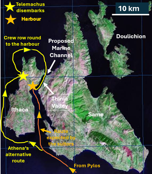
(Modified from Odysseus Unbound, 90, Fig. 10.6).
The Homeric narrative is decidedly against this. The suitor Amphinomos sees that the ship has reached the harbour of Ithaca. What is his reaction? On Robert’s reconstruction, it should be “Damn it! They’ve eluded the ambushers in the strait by taking the northern channel route home. Why didn’t we think of laying an additional ambush in the channel?” That is not his reaction. He says “Either some god has tipped them off, or they themselves [the ambushers] / Spotted the ship sail past and couldn’t catch her” (16.356–7). Amphinomos envisages only one route, the route through the strait.
Now, to tie all these ends together. There are two facts which are indisputable. First, Homer never describes Ithaca as an island. Second, there is no evidence that Homer thought of Ithaca as an island.
From these facts I deduce the following conclusions. Homeric Ithaca was a peninsula joined to a larger land mass, which is sometimes called the mainland. There is, then, a single island, consisting of two parts. These two parts have their own names. The western peninsula is Ithaca, the eastern part is Same/Samos. Ithaca is the home of Odysseus, ruler of that joint island. That joint island is Cephallenia, the name by which later writers call it. Homer does not call it Cephallenia, for a very simple reason: the word Cephallenia will not fit into the metrical pattern of Homeric verse.
However, the name “Cephallenians” fits, and Cephallenians is the name by which Homer, on several occasions, refers to the inhabitants of the island, whether they come from Ithaca or Samos/Same. Remember that passage in the Iliad: “Odysseus led the gallant Cephallenians”, and they are described as coming “from the mainland and the region opposite” (that is from Samos/Same and Ithaca). The name reappears only once in the Iliad (4.330), and again it refers to the troops led by Odysseus. It appears several times in the Odyssey. Philoitios, who brought the cattle across to Ithaca, tells how, in his youth, he had been given charge of Odysseus’ cattle Κεφαλλήνων ἐνὶ δήμωι, “in the land of the Cephallenians” (20.210), i.e. Samos/Same. Laertes, Odysseus’ aged father, says “When I was ruler of the Cephallenians” (24.378). And we hear of “the towns of the Cephallenians” (24.355), where some of the suitors come from (some, at least, of these will be on Samos/Same). The suitors themselves are called “noblest of the Cephallenians” (24.429).
By the 5th century BC, the peninsula was no longer called Ithaca: the whole island, including the peninsula, was now called Cephallenia, as Herodotus (9.28.5) and Thucydides (2.30.2) clearly show.[11] But Ithaca was a name deeply embedded in the consciousness of the Greeks. They could not allow Ithaca to go missing. And when they began to ask where it might be and failed to see that it was the peninsula of Paliki (an understandable failure, for Ithaca was an island, was it not?), they found it in the island which Homer calls Doulichion and which we now called Ithaki.[12]

James Diggle is Emeritus Professor of Greek and Latin in the University of Cambridge and a Life Fellow of Queens’ College. He was University Orator, 1982–93. He is a Fellow of the British Academy and a Corresponding Member of the Academy of Athens. He was appointed CBE (Commander of the Order of the British Empire) in 2022. He is the editor of the Oxford Classical Text of Euripides (3 vols, 1981–94). His most recent publications are a revised edition of vol. 2 and Last Thoughts on Euripides: A Companion to the Revised Edition of the Second Volume of the OCT (2025). He is also Editor in Chief of The Cambridge Greek Lexicon (2021).

John Underhill is the Director for Energy Transition at Aberdeen University, a Chartered Geologist and Fellow of the Geological Society and Royal Society of Edinburgh. He has held academic posts at Edinburgh, Heriot-Watt and Aberdeen Universities. He is the recipient of the Geological Society’s Lyell Medal, the European Association of Geoscientists and Engineers (EAGE) Wegener Medal and the Edinburgh Geological Society’s Clough Medal. He is a member of the UK Energy Minister’s Subsurface Task Force and was on the Scottish Science Advisory Council (SSAC), the leading independent scientific advisory board for Scottish Government. For many years he was also a professional football referee and in 2001 was promoted to the FIFA List of International Referees.
Dedication
We dedicate this paper to the memory of Robert Bittlestone (1952–2015), the driving force behind the search for Odysseus’ homeland, ancient Ithaca, and the cause of our more than twenty-year long collaboration.
Acknowledgements
We gratefully acknowledge the support of the Trustees of the Odysseus Unbound Foundation, FUGRO, and the Natural Environment Research Council, all of whom provided funding for the research. We thank Peter Styles, Jean-Luc Swenninger, Maria Triantaphyllou, Kirsten Hunter, Ruth Hamilton, Dave Kilcoyne, Steve Poulter and Steve Thompson for their geotechnical support, and Grigorios Grigorakakis and Eleni Papafloratou in the Ephorate of Cephalonia and Isidoros Kampolis in the Hellenic Survey of Geology and Mineral Exploration (HSGME) for issuing the work permits that enabled the geoscientific fieldwork to be undertaken and samples to be exported for analysis.
For information about the Odysseus Unbound Foundation, which was established after Robert Bittlestone’s death, as well as reports of past and ongoing work, see its website www.odysseus-unbound.org.

Notes
| ⇧1 | For discussion of some of the linguistic details in this passage see Odysseus Unbound, 520. |
|---|---|
| ⇧2 | See Odysseus Unbound,77–8, 552. |
| ⇧3 | The evidence that the island now called Ithaki continued to have the alternative name Doulichion (or Doulichia) until quite recent times is presented in Odysseus Unbound, Chapter 21. See further n.12 below. |
| ⇧4 | Sir Arthur Conan Doyle, in the short story The Adventure of Silver Blaze’(1892). |
| ⇧5 | “The line which is numbered 608 in this translation [“Goat-land…”] appears in the manuscripts after line 605 [“Ithaca has…”]. The sequence of thought, and the grammatical structure, is improved if we place it at the end of the passage, as a nineteenth-century scholar [Bergk] suggested” (Odysseus Unbound, 524). In advocating this transposition, I was following Stephanie West (A Commentary on Homer’s Odyssey, Vol. I [Oxford UP, 1988]). |
| ⇧6 | The lines are repeated at 16.122–4 and with a slight variation in the third line (οἵ τ᾽ αὐτὴν Ἰθάκην εὐδείελον ἀμφινέμονται) at 19.130–2. |
| ⇧7 | At Od. 1.103, 14.126, 329, 15.534, 16.419, 19.399, 22.52, 24.284, Il. 3.201. |
| ⇧8 | That Apollonius should apply it to an island is no surprise. His phrase Δίηι ἐν ἀμφιάλωι is modelled on Homer’s Δίηι ἐν ἀμφιρύτηι (Od. 11.325). Deliberate variation of Homeric phraseology is his hallmark. |
| ⇧9 | See Odysseus Unbound, Chapter 10. |
| ⇧10 | See Odysseus Unbound,89–91. |
| ⇧11 | See Odysseus Unbound,275–6. |
| ⇧12 | See n.3 above. The celebrated Greek archaeologist Spyridon Marinatos, who also held that Paliki (on which he conducted excavations) was Homer’s Ithaca, suggested an alternative, and perfectly feasible, explanation why the name Ithaca was transferred to Doulichion (Ithaki): that devastation of Ithaca (Paliki) by an earthquake led to the migration of its inhabitants to a new home on Doulichion, to which they took their original name. See John Crawshaw, “The search for ancient Ithaca,” Argo: A Hellenic Review 17 (2023) 10–14 (available here). |